April 28, 2011

Thursday

US: Current Weather

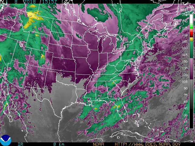
It is about the same temperature as yesterday, around 35 F with a little drizzle currently occurring.  There is a moderate wind coming from the NW and should push the rain away from the area later on today.  The skies are overcast with stratus and nimbostratus clouds.  Tomorrow should be a great day as the clouds move out and the temperature warms up and there should not be any rain because the wind coming from the NW today.  The weekend will be raining again and cooler so the nice weather tomorrow will not stick around long.

April 27, 2011

Wednesday


Today is a little cooler than yesterday with a temperature around 39 F and it is currently drizzling outside.  There is a moderate wind coming from the NW which is bringing in cooler air to the region.  The skies are complete overcast with stratus and nimbostratus clouds.  The rain should continue throughout the day and be done by tonight sometime because of the wind direction coming from the NW.  Tomorrow should be a little warmer with less cloud coverage and a smaller chance for precipitation.

April 26, 2011

Tuesday

current color enhanced goes east infrared image

It is cool and raining outside with a temperature of about 39 F, with a moderate wind direction coming from the NW.  The skies are complete overcast with stratus and nimbostratus clouds.  The rain should continue for a little while longer today.  Tomorrow should be a little warmer with less clouds, but there also could be a chance for more rain because of the wind direction and the cloud types still in the area today.

April 22, 2011

Friday

current color enhanced goes east infrared image

It is a little cooler than yesterday with a temperature around 35 F and a moderate wind coming from the SE.  The skies are overcast with stratus clouds and we can expect some precipitation later on today and into tomorrow morning.  The weekend should be warmer, but with chances of precipitation during the whole weekend. 

April 21, 2011

Thursday


Today is a little bit warmer than yesterday with a temperature around 45 F and a moderate wind coming from the SE which is bringing in the warmer air.  The skies are partly cloudy about 60% with most of the cloud types being cirrostratus, altostratus, and altocumulus.  With the mixed sky and the winds from the SE, there is a good chance that some precipitation is on the way either late tonight or tomorrow.  Tomorrow will be about the same conditions except with more clouds and precipitation in the region. 

April 20, 2011

Wednesday

current color enhanced goes east infrared image

It is a little cooler than yesterday with a temperature around 30 F and there was snow falling earlier this morning, but now as changed over to a light drizzle.  There is a moderate wind coming from the NW which indicates the precipitation should move out of the area later today.  The skies are complete overcast with stratus and nimbostratus clouds.  Tomorrow should be a little warmer with less cloud cover and no precipitation occurring because the winds are coming from the NW today. 

April 19, 2011

Tuesday

North Central US Current Weather

It is a little cooler than yesterday with a temperature around 30 F and a strong wind coming from the NE.  The skies are overcast with stratus clouds and this indicates precipitation should be on the way because of the low clouds and the wind coming from the NE.  Tomorrow should be about the same conditions along with precipitation during the early parts of the day and should clear off a little bit later on in the day. 

April 18, 2011

Monday

North Central US Current Weather

It is a little warmer than it was over the weekend with a temperature around 40 F.  There is a slight wind coming from the East so there should precipitation on the way later today and tomorrow.  The skies are partly cloudy, about 80% cloud cover and most of the cloud types are altostratus and cirrus.  Tomorrow should be a little cooler with more lower clouds in the area, probably an overcast sky of stratus clouds and will bring precipitation later in the afternoon tomorrow. 

April 15, 2011

Friday

current color enhanced goes east infrared image

Today is cooler than yesterday with a temperature around 31 F and there are fast winds coming from the East.  The skies are complete overcast with stratus clouds and we should expect some rain later on in the day.  Tomorrow will be cooler with a high chance of precipitation and the skies will be mostly cloudy throughout the day as well.

April 14, 2011

Thursday


It is cooler today with a temperature around 35 F and also there is a heavy wind coming from the NE.  The skies are overcast with mostly stratus clouds.  Tomorrow should be about the same temperature with overcast skies and a chance for rain later in the day because of the low stratus clouds and the winds coming from the NE today, this shows precipitation is possible sometime tomorrow. 

April 13, 2011

Wednesday

North Central US Satellite

It is about the same temperature as yesterday, around 50 F with a moderate wind coming from the NE.  The skies are partly cloudy, about 40% cloud coverage with most of the cloud types being cumulus and altostratus.  There could be a chance of a little bit of rain later today if the wind continues to come from the NE and East.  Tomorrow should be a little cooler with less cloud coverage because once the rain moves through later today then their should be a high pressure system moving into the area. 

April 12, 2011

Tuesday

 current color enhanced goes east infrared image

It is a little warmer than yesterday with a temperature around 60 F and a moderate wind coming from the SW which is bringing in warm air to the region.  The skies are partly cloudy, about 30% with most of the cloud types being cirrus and cirrostratus.  Tomorrow should be a little bit cooler with an increase of cloud coverage and a chance for some rain because of wind direction and cloud types that appear today. 

April 11, 2011

Monday

US: Current Weather

The temperature is much cooler than yesterday as a cold front moved through the area after the big storms, about 50 F right now.  There is a moderate wind coming from the NW which indicates there should not be much, if any precipitation today.  The skies are overcast, about 90% with most of the cloud types being cumulus, and cumulostratus.  The clouds should clear away throughout the day and the temperature should drop a little bit.  Tomorrow will be about the same conditions with less clouds and a lower temperature.

April 8, 2011

Friday

current goes east conus color enhanced infra red image

The temperature is a little cooler than yesterday, about 45 F and should increase throughout the day.  There is a very slight wind coming from the SE which is bringing warm air and also chances for precipitation for the weekend.  The skies are partly cloudy, 30% with most of the cloud types being altostratus.  Tomorrow should be about the same conditions with increasing cloud cover and a chance for rain later in the afternoon because the wind is coming from the SE and the clouds have gone from cirrus yesterday to altostratus today and is a sign of a warm front moving into the area. 

April 7, 2011

Thursday


It is a little bit warmer than yesterday with a temperature around 50 F.  There is a moderate wind coming from the SE.  The skies are partly cloudy about 30% cloud cover with the types being cirrus, cirrostratus, and altostratus.  Tomorrow should be about the same conditions with a chance of rain coming later in the day because the wind is coming from the SE and there should also be an increase in cloud coverage. 

April 6, 2011

Wednesday

current color enhanced goes east infrared image

It is much warmer than yesterday with a temperature around 47 F and a slight wind coming from the N.  The skies are mostly clear with about 30% cloud coverage and most of the cloud types being cirrus, cirrocumulus, and cumulus.  Conditions should be about the same later on today and tomorrow.  Looking at the water vapor map, there could be some precipitation coming this way and could be here by late tomorrow afternoon.  Depending on cloud types and wind direction tomorrow could determine whether or not precipitation will be coming to the area. 

April 5, 2011

Tuesday

North Central US Current Weather

It is much warmer than yesterday with a temperature around 40 F.  There is a slight wind coming from the SW which is bringing in warmer air.  The skies are mostly clear, about 10% cloud coverage with most of the cloud types being cirrus and cirrostratus.  Cloud coverage should increase throughout the day and into tomorrow and there also could be a chance of precipitation later tonight and tomorrow.  Conditions should be about the same tomorrow with a little more cloud coverage, but the temperature should be around the same as today. 

April 4, 2011

Monday

current color enhanced goes east infrared image

It was raining earlier this morning, but now has stopped and should not start again until later on in the day.  The current temperature is fairly cool, about 30 F and there are high winds coming from the NW bringing down cool air from the north.  The skies are overcast with most of the cloud types being stratus, nimbostratus, and stratocumulus.  There could be a chance for rain later on today and into tomorrow, but since the wind is coming from the NW there should not be much precipitation.  Tomorrow should be a little warmer because the wind will be coming from the south, bringing in warmer air and there should also be some clouds in the sky. 

April 1, 2011

Friday

current color enhanced goes east infrared image

It is a little cooler than yesterday as predicted with a temperature around 30 F.  There was some snow in the early morning.  There is a very slight wind coming from the East which will continue to bring precipitation.  The skies are completely overcast with most of the clouds being stratus and nimbostratus.  There could be a little more precipitation throughout the day, but should not be much more.  Tomorrow will be about the same temperature and the precipitation will move out of the region.  Some clouds should clear away and the wind will be coming from the NW.  Off to the east coast there is a nor'easter currently hitting the area bringing a lot of snow to the region.